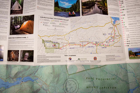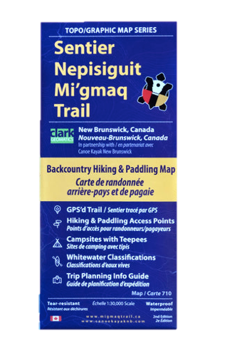


If you plan to hike or paddle the Nepisiguit Mi'gmaq Trail this map is one of the most important pieces of equipment you will need. This 1:30,000 scale topographical map was created by trail volunteers from the Nepisiguit Mi'gmaq Trail who know the trail intimately.
The map includes everything you need to know about hiking or paddling the 150 km backcountry hiking trail that follows the Nepisiguit River from Mount Carleton Provincial Park all the way to Daly Point Preserve on Bathurst Bay. The waterproof, tear resistant, fully bilingual map is jam packed with information about trail access points, campsites with Teepees, Whitewater Classifications, a trip planning info guide, and the history of the trail.
Free shipping in Canada on all orders over $75 *exclusions apply